Pages

Thursday 31 October 2013

Tuesday 22 October 2013

Writing Toolkit

This is my presentation about a Writing Toolkit. The reason we did this was to be better writters.

My 6 Hats thinking presentation

The reason we did this activity was to understand the amount of rubbish there is in the Tamaki River Estuary. 

Monday 21 October 2013

Xtramath

This is my Xtramath result that I completed today. I was faced with the higher numbers in comparison with the lower equations. I have improved but not by much. Please leave a comment.

Quaid Using Te Ara

Using Te Ara -
The Encyclopedia of New Zealand
2. Tamaki River

L.I.    Develop our knowledge of Auckland and the Tamaki river
    Familiarise ourselves with an online NZ encyclopaedia

Use this link to open Te Ara
Enter Tamaki river into the search box and use the Eastern suburbs: Oraki  to the Tamaki estuary page to answer these questions.

Where does the river flow from and to? The river flows from Mangere east to a tidal estuary on the Waitemata.

What was the link used by Maori called?
The link is called Otahuhu portage to the Manukau .

What two bodies of water does it join?
The two bodies are Manukau and the Waitemata harbour

What sort of landform is Tāhuna Tōrea?
It is a sandspit

What is the name of the marina on the Tamaki river?
It is called Half moon bay

When was the first Panmure Bridge built?
It was built in 1866

When was the current bridge built?
It was built in 1959

Thursday 17 October 2013

Xtramaths

This is my Xtramath result. I improved alot by last time.

Monday 14 October 2013

Spelling Activity LVL47

     Synonyms and Antonyms

L.I. - To know the parts of speech and to be able to use parts of speech in our writing

Synonyms are words with a similar meaning.
Antonyms are words with the opposite meaning.

Synonyms
abode-home
fragrance-perfume
brilliant-excellent
hurry-rush
start-begin

Antonyms
wide-narrow
start-stop
  • brilliant- unintelligent
hurry-delay
carefully-roughly

Prezi

Library Skills - Using Te Ara


Using Te Ara -
The Encyclopedia of New Zealand
1. Waitemata Harbour

L.I. Develop our knowledge of Auckland and the Tamaki River.
Familiarise ourselves with an online NZ encyclopaedia.
Use our skimming and scanning skills.

Use this link to open Te Ara
Enter Waitemata into the search box and use that page to answer these questions.

What sort of landform is the Waitemata harbour?
The Waitemata Harbour is a drowned river valley.

Why was it chosen to be New Zealand’s capital?
Because it is a navigable channel and its sheltered bays helped to determine Lieutenant-Governor Hobson’s choice of a site for New Zealand's capital in 1840.

What does Waitemata mean?
Waitemata means obsidian waters - The glassy surface known as obsidian rock.

Tell me one interesting fact about each of these features of the Waitemata-It has tidal flats and mangroves in the upper reaches to the west, and sandy bays with sandstone cliffs along the eastern shores.

Auckland’s chief port -By 1900, 132 acres (53 hectares) of land had been reclaimed from the harbour.

Viaduct basin -The Viaduct Basin, site of the old fishing harbour, was redeveloped in the mid-1990s as a site where the Royal New Zealand Yacht Squadron could host the America’s Cup in 1999 and 2003.

Westhaven -The Westhaven Marina, with 1,800 berths, is the largest managed marina in Australasia, and a symbol of Aucklanders’ love of sailing.

Harbour bridge -It was the last bridge in the world constructed with a steel lattice girder.

Greenhithe bridge - The Greenhithe Bridge was built in 1975 as an alternative harbour

Natural features -It was formed by lava flowing from the Three Kings eruption 20,000 years ago.
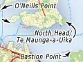
Map


Xtramaths

My first result for the term was a good one because I scored no crosses or time diffulculties.